SITE & CLIMATE


Understanding the site and climate of a particular project site is fundamental to any bioclimatic design.
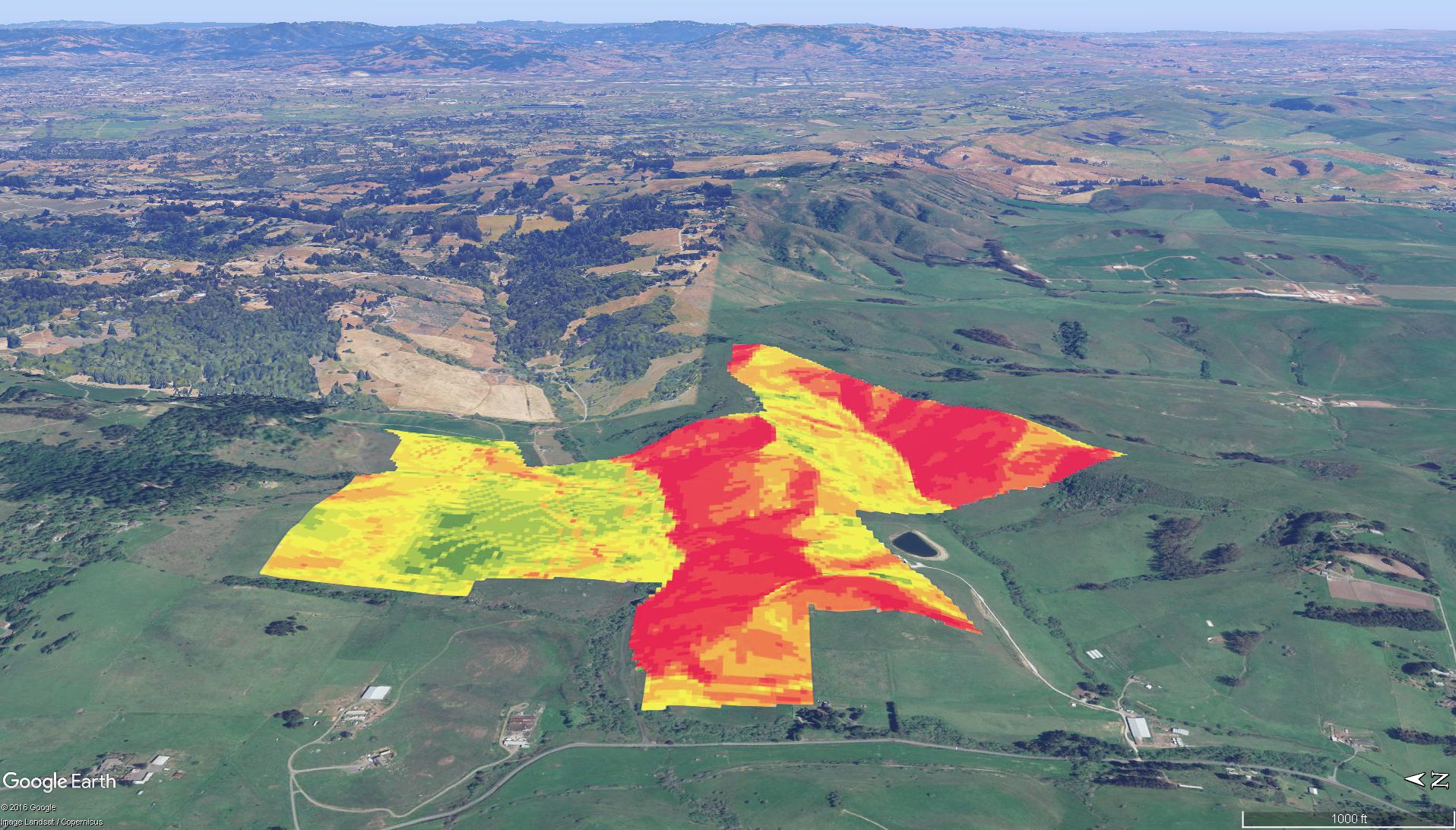
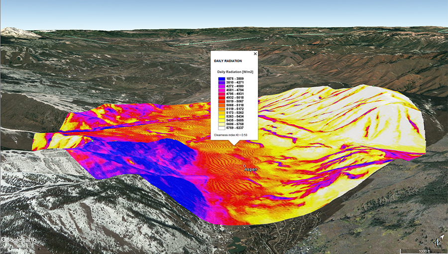
Using a combination of Geographic Information System tools (GIS), one can remotely determine certain topographical features such as slope, aspect and incident solar radiation. Parametric mapping can then be done by determining desired features such as low slope, views and solar radiation. Such maps are helpful to identify optimum building location on a site.
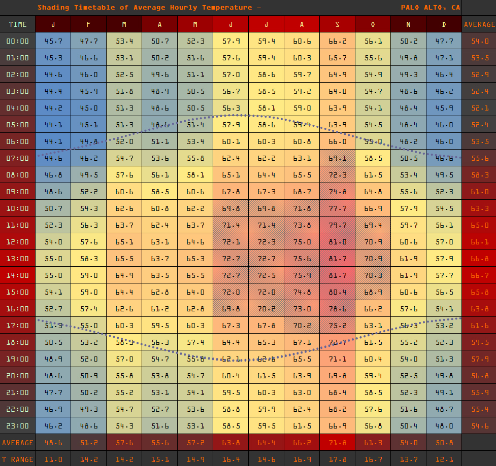
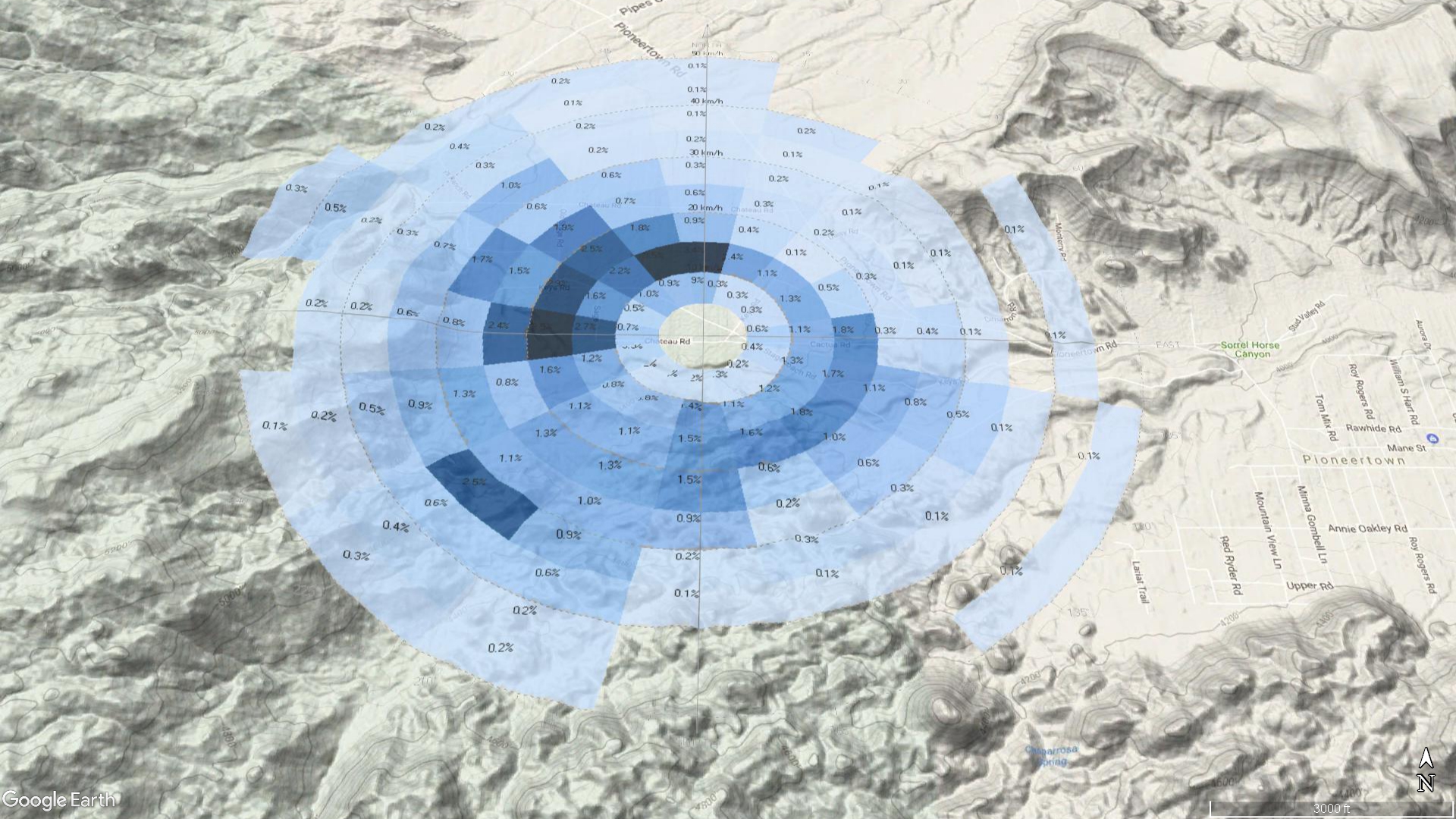
In addition, climatic data can be analyzed to assess the best passive design strategies that will lead to the best human comfort given the particular climate. As such, this helps designers to identify what strategies offers the best “bang for the buck”.